

From Maps to Intelligence: GNPC Advances Geospatial Technology for Smarter Energy Decisions
Accra, Ghana — The 2026 Esri Conference, held at the Mövenpick Ambassador Hotel in Accra, brought together industry leaders, technology experts, and public-sector stakeholders to explore how geospatial data and technology can unlock new opportunities, improve decision-making, and drive sustainable development across West Africa.
Held under the theme “Connecting Data, Creating Value, Building a West Africa Geospatial Ecosystem,” the conference explored the transformative potential of geospatial innovation, with discussions centered on leveraging data, technology, and collaboration to unlock value, improve decision-making, and support sustainable development across the region.
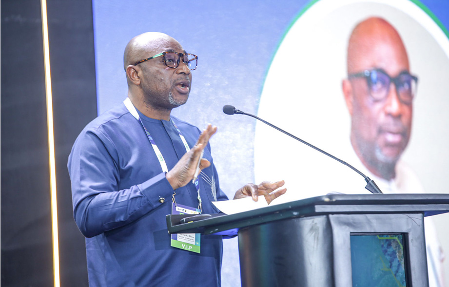
Delivering a keynote address on behalf of the Chief Executive Officer of the Ghana National Petroleum Corporation (GNPC), Director of the Subsurface Division, Mr. Vincent Hotor, highlighted the growing role of geospatial intelligence in shaping energy decision-making across the region.
In his address, Mr. Hotor noted that the key challenge facing organisations today is no longer access to data but the ability to connect, integrate, and derive meaningful insights from it. He asked, “Are we connecting our data well enough to make better decisions?” which underscores the importance of data integration and informed decision-making in shaping geospatial strategy.
For GNPC, he explained, this means integrating data from seismic surveys, geological studies, production records, engineering systems, environmental assessments, satellite imagery, and sensor networks to create a unified and comprehensive view of the Corporation’s assets, opportunities, and risks. Such integration, he noted, can strengthen analysis, support informed decision-making, and enhance the Corporation’s ability to maximise value from its data.
He highlighted GNPC’s growing use of geospatial technology across the petroleum value chain, supporting exploration planning, infrastructure development, field operations, safety management, environmental protection, and the unlocking of stranded resources. He noted that geospatial analysis enables the Corporation to integrate factors such as terrain, hazards, environmental sensitivity, constructability, and cost to identify optimal solutions, illustrating that the shortest route is not necessarily the best and that informed decisions require considering geography alongside engineering, flow assurance, and economics.
Looking ahead, Mr. Hotor outlined GNPC’s ambition to establish a corporate-wide geospatial network and common operating picture, connecting teams across exploration, subsurface, engineering, projects, production, HSE, and operations through a single source of authoritative information. He stressed the potential of integrating GIS with artificial intelligence, remote sensing, sensor technologies, and digital twins to strengthen risk anticipation, infrastructure monitoring, and scenario planning, enabling the Corporation to make more informed decisions before committing capital.
Speaking on GNPC’s 2026 Special Achievement in GIS recognition, Mr. Hotor described the honour as more than an accolade but a call for the Corporation to advance its use of geospatial intelligence. “Let us move from maps to intelligence, from intelligence to action, and from action to value,” he said, underscoring GNPC’s ambition to translate geospatial insights into tangible business value.
GNPC’s participation in the 2026 Esri Conference underscores the Corporation’s commitment to advancing geospatial intelligence and data-driven technologies to support better decision-making, optimise operations, and strengthen its strategic positioning. The engagement also reflects GNPC’s continued efforts to leverage innovation to enhance value creation across the petroleum value chain and contribute to Ghana’s sustainable development.