

GNPC Earns Global Recognition for Innovative Use of Geospatial Technology
The Ghana National Petroleum Corporation (GNPC) received the 2026 Esri Special Achievement in GIS (SAG) Award, recognising its innovative use of geospatial technology to support petroleum development, data-driven decision-making, and Ghana’s long-term energy security.
The award was presented during the Esri User Conference held in San Diego, California, where GNPC was among 197 organisations recognised globally for outstanding application of Geographic Information Systems (GIS) from within Esri’s global community of more than 700,000 organisations.
The recognition follows GNPC’s application of GIS to support efforts to increase Ghana’s oil and gas production in the development and commercialisation of stranded and marginal petroleum resources.
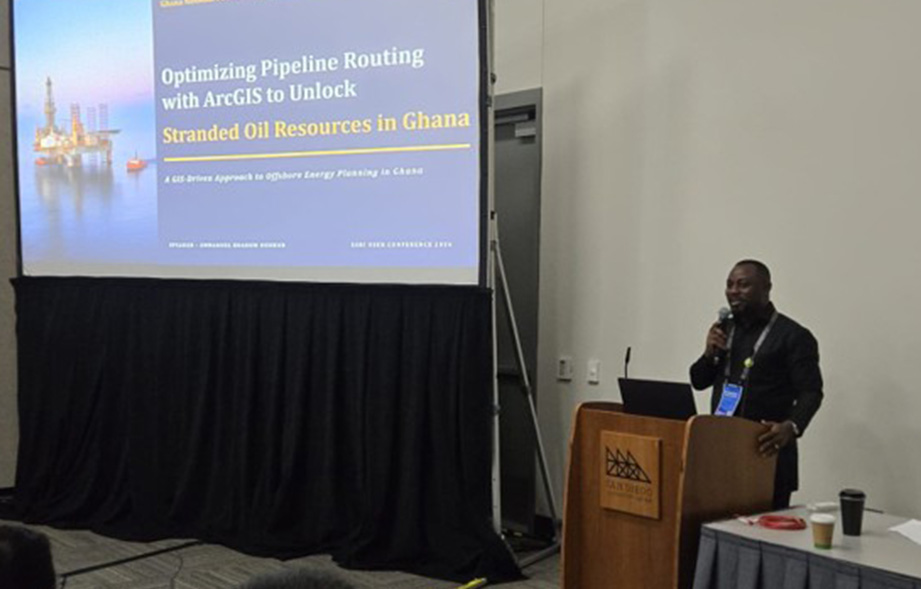
At the conference, GNPC Senior Geomatic Engineer Mr Emmanuel Boadum Donkor delivered a technical presentation titled "Optimising Pipeline Routing with ArcGIS to Unlock Stranded Oil Resources in Ghana.” The presentation demonstrated how GNPC is using geospatial analysis to identify technically feasible pipeline corridors and evaluate routing options for connecting stranded and marginal offshore resources to existing infrastructure and proposed production hubs.
The work integrates information on seabed conditions, existing offshore infrastructure, environmental constraints, geohazards, and engineering requirements to support pipeline planning, concept selection, cost estimation, and investment decisions. By bringing these datasets together in a single decision-support environment, GIS enables geoscientists, engineers, economists, and management to assess development options more efficiently and make informed decisions on the commercialisation of petroleum resources.
GNPC Chief Executive Officer Mr Kwame Ntow Amoah described the recognition as an affirmation of the Corporation’s growing technical capability and its commitment to applying innovation to Ghana’s energy priorities.
“This recognition reflects the quality of work being delivered by our technical teams and the important role of data and technology in GNPC’s operations. As we work to increase production and build stronger operatorship capability, we will continue to invest in solutions that improve decision-making, strengthen efficiency, and create lasting value for Ghana,” he said.
Beyond the award and technical presentation, the delegation engaged Esri’s global petroleum and natural resources leadership on opportunities to strengthen GNPC’s Enterprise GIS platform and support the Corporation’s wider digital transformation agenda.
The team also participated in technical sessions covering GeoAI, remote sensing, drone-based mapping, high-accuracy field data collection, pipeline management, and advanced geospatial analytics capabilities with potential applications across exploration, field development, operations, asset management, and environmental monitoring.
Mr Vincent K. Hotor, Director, Subsurface, who led GNPC’s delegation to the conference, said the award highlighted the growing contribution of the Corporation’s Geomatic Engineering team in achieving GNPC’s strategic objectives.
“GIS has developed beyond a conventional mapping function into an important business and decision-support capability. This recognition reflects the dedication of the team and the relevance of its work to exploration, field development, infrastructure planning, and resource optimisation,” he noted.
The achievement at the SAG Awards places the Corporation among organisations recognised by Esri for applying geospatial technology to address complex operational and development challenges.
For GNPC, the award also highlights its commitment to developing the technical systems, people, and partnerships required to support efficient operations, decision-making, and the responsible development of Ghana’s petroleum resources.