

GNPC Explores Hub-Based Development to Unlock Stranded Tano Basin Resources
The Ghana National Petroleum Corporation (GNPC) is using geospatial analysis to assess how stranded and marginal petroleum resources in the Tano Basin could be developed through shared infrastructure as part of efforts to identify cost-effective options to increase Ghana’s oil and gas production.
The approach involves evaluating opportunities to connect multiple petroleum discoveries to existing infrastructure or proposed production hubs, rather than developing each resource independently. By sharing infrastructure, the concept could reduce capital requirements and improve the commercial viability of resources that may otherwise be challenging to develop on a standalone basis.
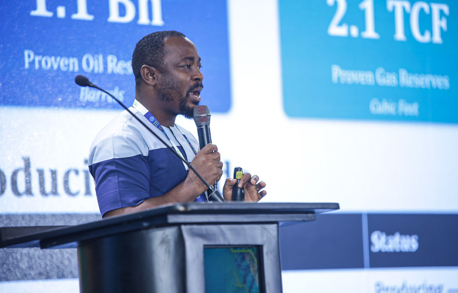
Presenting the work at the Esri User Conference West Africa 2026 in Accra, GNPC Senior Geomatic Engineer Mr. Emmanuel Boadum Donkor said the analysis covers potential fields in the Tano Basin containing more than one billion barrels of oil and approximately 2.5 trillion cubic feet of gas.
He clarified that the figures relate to resources associated with potential developments under assessment and do not represent new petroleum discoveries or approved additions to Ghana’s production. Their eventual contribution to national production would depend on the outcome of further technical and commercial assessments, as well as the necessary regulatory and investment approvals.
According to Mr. Donkor, geospatial technology is enabling GNPC to examine how these resources could be aggregated and connected to available or proposed infrastructure to improve development economics.
“If you take up the CAPEX in terms of developing the infrastructure to extract these stranded resources independently, if you compare it to doing it in the hub way which we are seeking to do, you realise that it brings down the cost of investment and then it actually boosts our confidence to be able to extract these stranded resources,” he explained.
The analysis brings together data on petroleum discoveries, existing infrastructure, and potential development routes with information on environmental sensitivities, settlements, and other surface and subsurface considerations. This enables technical teams to assess alternative development scenarios, including potential infrastructure configurations and routing options, before making significant investment decisions.
Mr. Donkor noted that location is particularly important to petroleum operations, with a significant proportion of GNPC’s technical information having a spatial component. Geographic Information System (GIS) technology therefore provides a common platform for integrating datasets and supporting collaboration across different technical disciplines.
The application of geospatial technology builds on GNPC’s broader efforts to use digital tools to support petroleum exploration and development. Earlier this year, the Corporation received the 2026 Esri Special Achievement in GIS Award for its use of GIS to evaluate pipeline routing options for the potential commercialisation of stranded and marginal offshore resources.
GNPC is also exploring integrating geospatial technology with artificial intelligence, remote sensing, real-time data, and digital twins to strengthen planning, asset monitoring, and operational decision-making across its activities.
While the hub-based development concept remains subject to further technical and commercial assessment and the necessary approvals, the work shows how GNPC is using geospatial intelligence to bring together petroleum resources, infrastructure, and other critical data to evaluate potential development pathways.
For the Corporation, the approach provides a basis for assessing practical and potentially more cost-effective options for unlocking stranded and marginal resources and supporting Ghana’s long-term oil and gas production outlook.